Why Are Floods Hitting Nepal Again? The Bhotekoshi Disaster Explained
Share:
 Read Time
This blog has 3780 words .This blog has 25816 characters.This blog take 13 minutes to read.
Nepal has witnessed another devastating flood, raising a difficult question: why do destructive floods keep happening in the Himalayas, sometimes even when there is little or no rain nearby?
On August 26, 2026, a catastrophic flood struck the Nepal–China border region, affecting Rasuwa and communities along the Bhotekoshi and Trishuli river corridors. The disaster destroyed infrastructure, disrupted cross-border transport and left thousands of families facing loss and uncertainty. Weeks later, on October 11, another sudden flood swept through the Budhi Gandaki valley in Gorkha, destroying houses and bridges and leaving people missing.
These disasters occurred in different river systems and had different reported triggers. Yet both demonstrate how quickly conditions in Nepal’s mountain valleys can change. A sudden release of water, a collapsing mountainside or a landslide blocking a river can turn a seemingly ordinary day into a life-threatening emergency.
Understanding the Bhotekoshi flood means looking beyond the destruction itself. It requires examining the geography of the Nepal–China border, the science behind sudden floods, the changing risks in the Himalayas and the steps needed to protect people living downstream.
What Happened During the Bhotekoshi Flood in Nepal?
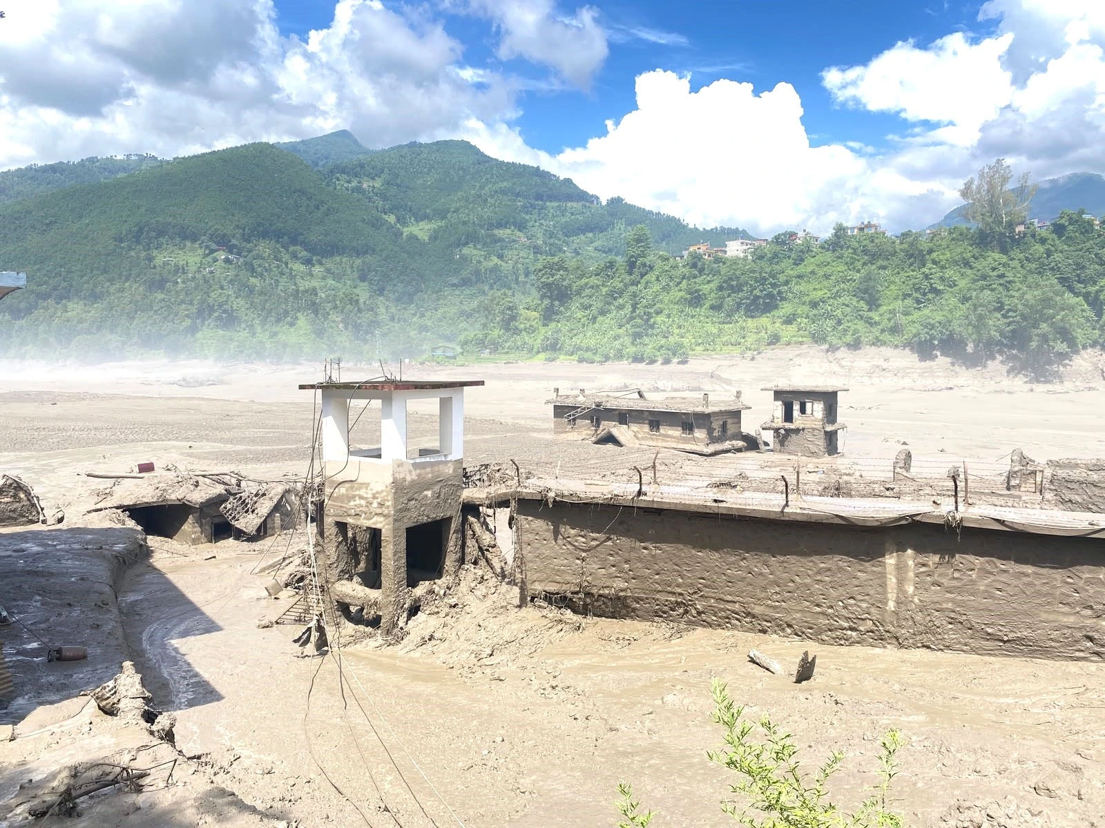
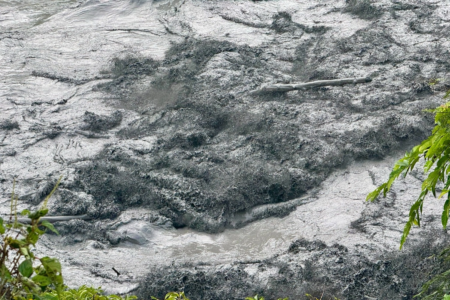
The August 26 disaster began near the Nepal–China border, in the Himalayan region around the Lhende Khola river system. A powerful flow of water, rock, ice and debris moved downstream, affecting settlements and infrastructure on both sides of the border.
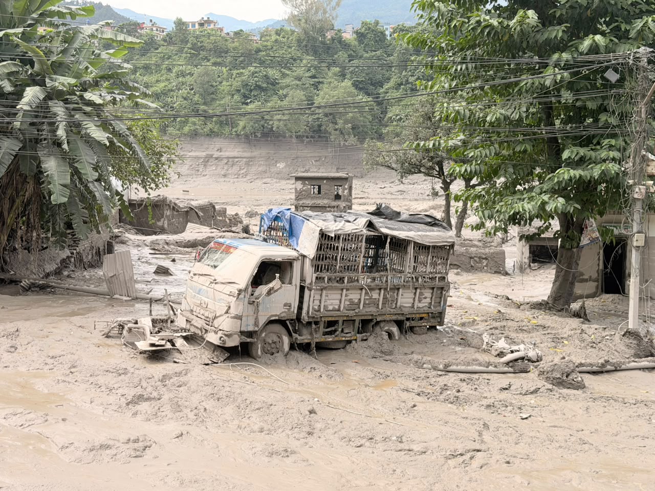
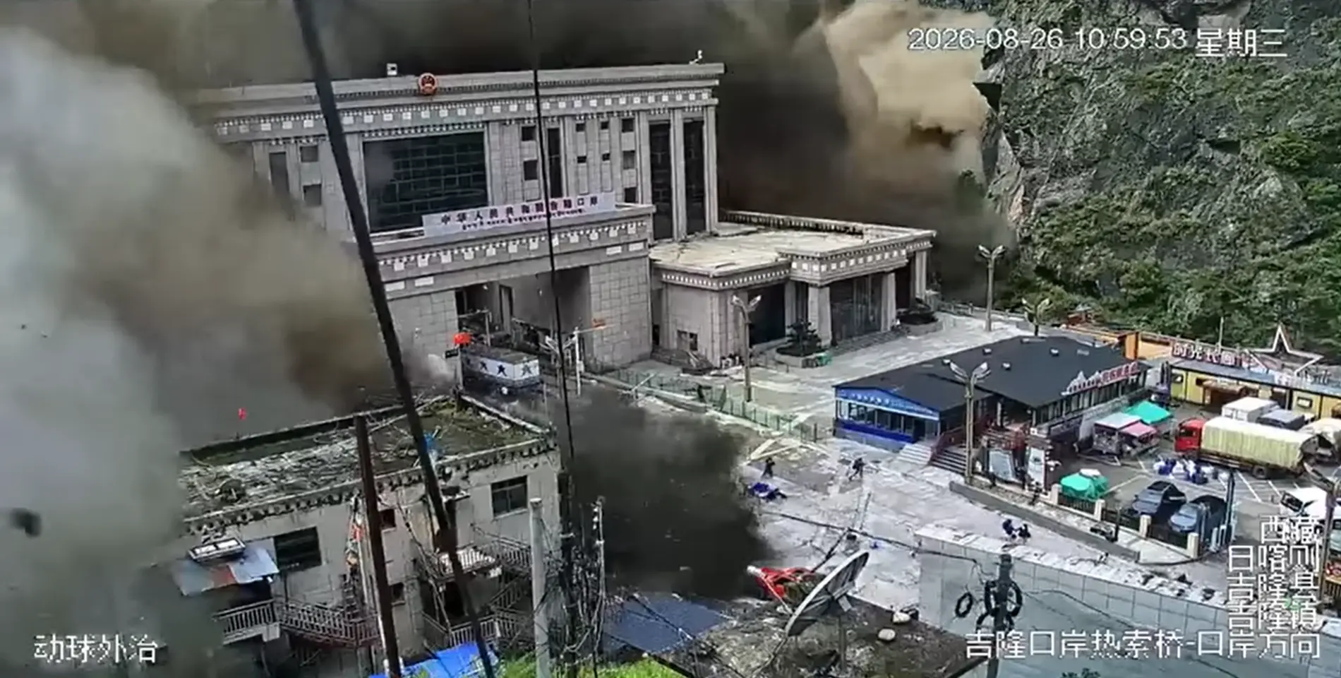
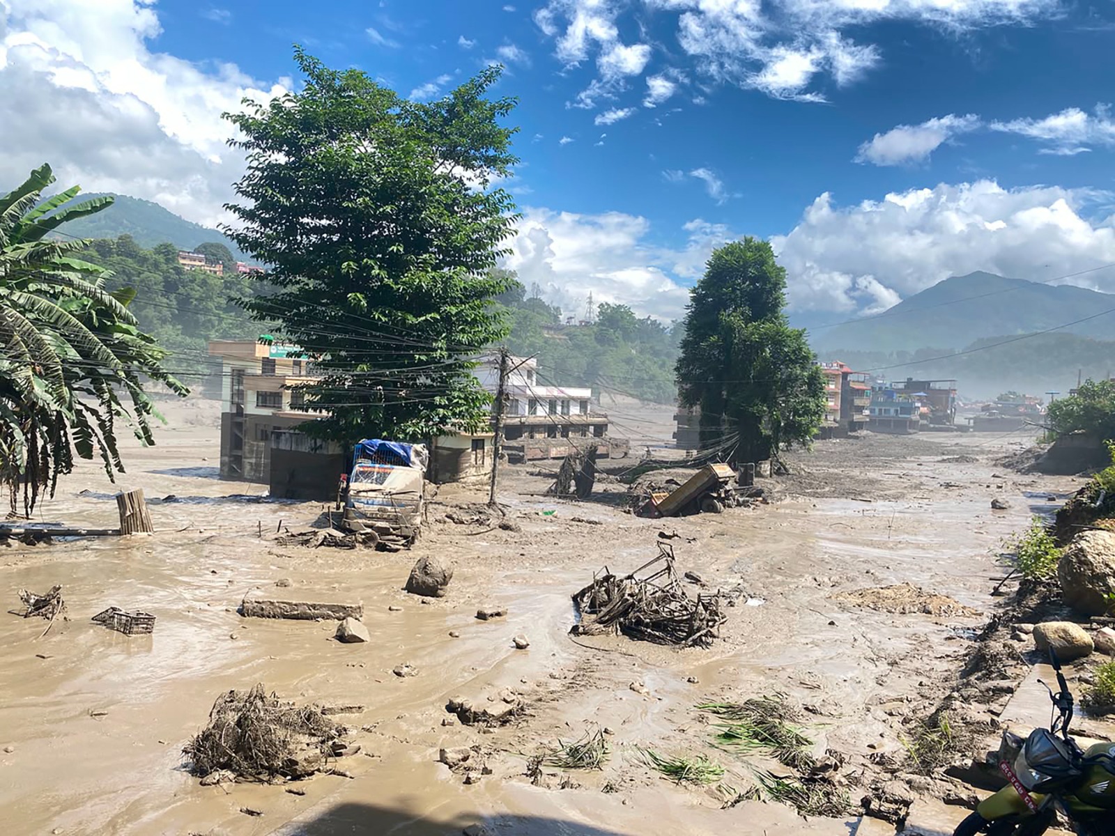
In Nepal, Rasuwa was among the worst-affected districts. The flood damaged the Rasuwagadhi border area, roads, bridges, hydropower facilities, businesses and homes. As the water moved downstream, it raised concerns along connected river corridors, including the Trishuli River.
The US Geological Survey reported that the disaster was likely triggered by a rapid slope failure involving a glacier in Langtang National Park, near the Chinese border. The resulting debris flow travelled almost 100 kilometres, affecting areas along the Lhende Khola and Trishuli river systems. The investigation identified a geological and glacial hazard, rather than evidence of a deliberate release of water by China. US Geological Survey: 2026 Nepal Debris Avalanche and Flash Flood.
The scale of the disaster became clearer over the following weeks. A provincial preliminary assessment reported on October 8 estimated 1,455 deaths and 5,285 people still missing. These were reported figures from the August disaster, not a final reconciled count of all casualties. The assessment also identified extensive damage to homes, bridges, roads and public infrastructure. The Kathmandu Post: Bagmati province seeks Rs1 billion for Bhotekoshi flood reconstruction.
The human consequences extend far beyond the initial rush of floodwater. Families have lost relatives, homes and livelihoods. Businesses have been damaged, transport routes disrupted and communities left facing a long process of recovery.
For residents of remote mountain settlements, a destroyed bridge is not merely a damaged structure. It can mean losing access to a hospital, school, market or the nearest road.
Why Is the Nepal–China Border Important in This Disaster?
The Nepal–China border follows some of the highest and most rugged terrain in the Himalayas. Glaciers, steep slopes, deep valleys and fast-flowing rivers shape this landscape. Several rivers originating in or flowing through the Tibetan Plateau descend towards Nepal, carrying water through narrow mountain corridors.
This geography creates a particular challenge: a dangerous event can begin far from the settlement that eventually suffers the damage.
A glacier can collapse, a landslide can enter a river, or a natural barrier can fail high in the mountains. The resulting flood wave may travel downstream before people living in lower valleys know that anything has happened.
The August disaster demonstrated this transboundary risk. Its effects were not confined to one village or one side of the international boundary. Damage affected the border area and transport infrastructure connecting Nepal with Tibet.
The border crossing at Rasuwagadhi is important for trade and movement between the two countries. When roads and bridges are destroyed, the consequences reach beyond the immediate flood zone. Cargo movement, local businesses, employment and supply chains can all be disrupted.
However, the international location of a disaster should not be confused with proof of responsibility. The fact that floodwater enters Nepal from the Tibetan side does not automatically mean that a dam, construction project or human activity caused it. Establishing the cause requires geological evidence, satellite observations, hydrological data and a credible investigation.
What the disaster does demonstrate is the importance of cooperation between Nepal and China. Both countries need effective systems for sharing information about dangerous glacial lakes, major landslides, river levels and sudden changes in upstream conditions.
Why Did the Bhotekoshi Flood Happen Without Heavy Rain?
One of the most confusing aspects of the August flood was the absence of heavy local rainfall that would normally explain such a sudden rise in water.
To understand this, it helps to distinguish between ordinary river flooding and a sudden release of water caused by a mountain hazard.
During conventional river flooding, prolonged rainfall or intense storms increase runoff across a catchment. Water enters streams and rivers faster than the river can carry it away, causing the water level to rise.
But a Himalayan flash flood can develop through a different chain of events.
In the August Bhotekoshi disaster, investigators identified a likely rapid slope failure involving a glacier. Rock and ice moving suddenly into a river can displace water, release stored water or generate a powerful debris flow. As the mixture moves downhill, it can collect additional rocks, soil, trees and sediment, making the flow even more destructive.
This is why checking the weather in a town does not always reveal the danger upstream. A community may experience clear skies while a destructive flood wave is already moving towards it from a distant mountain valley.
Several mechanisms can produce this kind of sudden flooding:
– Glacial collapse or an ice-and-rock avalanche that enters a river.
– A glacial lake outburst flood, when water stored in a lake is suddenly released.
– A landslide that blocks a river and creates a temporary natural dam.
– The sudden failure of a natural dam, releasing accumulated water downstream.
– A combination of heavy rainfall, slope failure and debris moving into a river channel.
These mechanisms can produce similar-looking destruction, but they are not interchangeable. The exact trigger must be established for each event.
For the August 26 disaster, the US Geological Survey’s preliminary assessment identified rapid slope failure involving a glacier as the likely trigger. That is a more specific explanation than simply saying that the flood happened because of climate change or heavy rain.
Another Flood in Nepal: What Happened in Gorkha on October 11?
The Bhotekoshi disaster was not the end of Nepal’s recent flood emergencies. On October 11, another sudden flood struck the Budhi Gandaki valley in Gorkha district, hundreds of kilometres of river corridor away from the Nepal–China border disaster.
According to Reuters and the Associated Press, a landslide near Chumnubri temporarily obstructed the Budhi Gandaki River. Water accumulated behind the blockage before the barrier failed, sending a sudden surge downstream.
Early reports stated that five people were missing. Houses and bridges were swept away, and a hydropower construction site, power infrastructure and communications facilities were damaged. Rescue teams used helicopters and ground operations to reach affected communities. Authorities also issued warnings to people in downstream areas.
The October flood is important because it illustrates another way that a Himalayan river can become dangerous without heavy rainfall in the immediate area. In this case, the reported mechanism was a landslide-created blockage, not the same glacier-related slope failure suspected in the August disaster.
The two events should not be treated as one continuous flood or assumed to have the same origin. They occurred in different river systems and require separate investigations.
However, they raise a common question: are Nepal’s communities adequately prepared for sudden mountain hazards that can develop upstream and arrive with little warning?
Sources: Reuters report on the October 11 flood and Associated Press coverage.

Why Do Floods Keep Happening in Nepal?
There is no single explanation for every flood in Nepal. The country’s geography, climate, geology and patterns of settlement combine to create several different types of flood risk.
1. Steep mountain terrain
Nepal’s rivers descend from high mountains through narrow valleys and steep channels. When a large volume of water enters these rivers suddenly, gravity drives it downhill at considerable speed.
The steep terrain also allows water to carry rocks, sediment and uprooted trees. These materials can strike bridges, damage buildings and obstruct river channels, increasing the destruction beyond what water alone might cause.
In narrow valleys, communities may have limited routes to higher ground. A bridge or road failure can quickly isolate settlements, making rescue and relief more difficult.
2. Glaciers and glacial lakes
The Himalayas contain glaciers and glacial lakes that are changing as temperatures rise. Some lakes have expanded, while new lakes have formed as glaciers retreat.
A glacial lake outburst flood, commonly called a GLOF, occurs when water held in a glacial lake is released suddenly. The release may follow the failure of a natural dam, an avalanche entering the lake or another destabilising event.
Research published in 2026 on glacial lakes in the China–Nepal Himalayas identified thousands of lakes and assessed risks to downstream buildings, roads, bridges and hydropower facilities. The study highlighted the need for better monitoring and cross-border risk assessment.
Climate change is an important part of this picture because it affects glacier mass, lake development and the stability of high-mountain environments. But not every flood in Nepal is a GLOF, and a specific disaster should not be attributed to global warming without evidence about its trigger.
3. Landslides and unstable slopes
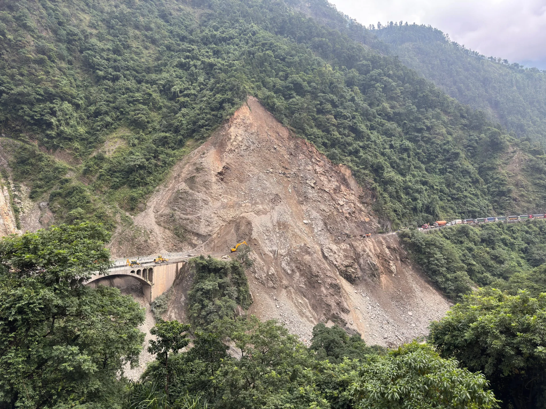
Landslides are another major hazard in Nepal’s mountain regions. Rock and soil can move into a river, temporarily blocking its flow.
At first, the blockage may resemble a natural dam. Water continues arriving from upstream and accumulates behind the debris. If the barrier becomes unstable or water overtops it, the blockage may collapse and release a sudden surge.
This mechanism was the reported trigger of the October 11 Budhi Gandaki flood.
A landslide can also release a large quantity of sediment directly into a river, creating a destructive debris flow. When that material moves through a narrow valley, it can damage structures and alter the river channel.
4. Intense rainfall and changing weather patterns
Nepal is vulnerable to monsoon rainfall, intense storms and localised downpours. Rainfall can increase river discharge rapidly, saturate slopes and trigger landslides.
A place may receive little rain while another part of the same catchment receives a much heavier downpour. Water from that upstream area eventually flows downstream, sometimes with a substantial delay.
Changing climate conditions can affect rainfall intensity, snow and ice melt, and the stability of mountain slopes. These factors can influence flood risk, but the relationship varies from place to place and between individual events.
The important point is that flood risk cannot be assessed by looking at rainfall over one village alone.
5. Infrastructure and settlement near rivers
People need access to water, transport, land and employment, so settlements and infrastructure often develop along river corridors.
But rivers are dynamic systems. They carry sediment, erode banks and can change their channels during extreme events. Roads, bridges, hydropower facilities and homes built in exposed locations may face serious risks when a river suddenly expands or carries large quantities of debris.
Construction itself does not cause every flood, and development can be necessary for local communities. The issue is whether infrastructure planning accounts for realistic flood levels, landslide exposure, river migration and emergency access.
Better risk mapping and careful construction standards can reduce exposure even when the underlying natural hazard cannot be eliminated.
Are the Bhotekoshi and Budhi Gandaki Floods Connected?
The two disasters are connected in the broader sense that both expose the dangers of sudden flooding in Nepal’s Himalayan environment. They are not, however, confirmed to be the same event or to have a common physical trigger.
The August Bhotekoshi disaster occurred near the Nepal–China border and was associated with a likely glacier-related slope failure. The October Budhi Gandaki flood was reported to have resulted from a landslide that temporarily blocked a river before the blockage failed.
Their similarities are important:
– Both involved sudden, destructive flows in mountainous river valleys.
– Both caused damage to homes, bridges and infrastructure.
– Both created serious challenges for rescue teams and isolated communities.
– Both showed that a dangerous event upstream can threaten people who have little direct visibility of the source.
Their differences are equally important. The locations, river systems and reported mechanisms were different. There is no verified evidence that the October flood originated in China or was a continuation of the August disaster.
A useful lesson is that Nepal needs to prepare for multiple types of mountain hazards, not just one particular kind of flood.

How Do These Floods Affect Nepal’s Economy and Border Trade?
Flood damage can continue affecting communities long after the water level falls.
The first impact is on homes and livelihoods. Families may lose houses, livestock, farmland, shops and stored food. Those who depend on farming, transport, tourism or small businesses can lose income at the same time that rebuilding expenses rise.
The second impact is transport. When bridges and roads are destroyed, people may have to take longer routes or wait until temporary crossings are built. Remote communities can become difficult to reach, delaying medical care, supplies and emergency assistance.
The third impact is hydropower and electricity. Floods and debris flows can damage construction sites, equipment, access roads, power lines and other facilities. Repairs may delay projects and interrupt local services.
The fourth impact is cross-border trade. Damage around the Rasuwagadhi corridor can disrupt cargo movement between Nepal and Tibet. Businesses that depend on imported goods, transport services and border traffic may experience delays and financial losses.
Finally, tourism can suffer. Nepal’s mountain landscapes remain a major attraction, but damaged trails, bridges, roads and accommodation facilities can affect travel plans and local income. Travellers should check current official advisories before entering affected areas rather than assuming that every trekking region is either safe or unsafe.
The wider economic cost includes reconstruction, temporary housing, public services, lost income and the long-term work required to restore infrastructure. Recovery is not simply about rebuilding what existed before. It is also an opportunity to make vulnerable infrastructure more resilient.
Could Another Sudden Flood Happen in Nepal?
Yes. Nepal remains exposed to flash floods, landslides, glacial lake outbursts and intense rainfall. However, that does not mean that another disaster of the same scale is inevitable or that every river is currently dangerous.
The risk depends on the condition of individual slopes and glacial lakes, weather patterns, river levels, local geography and the presence of people and infrastructure in exposed areas.
Some hazards can be monitored. River gauges can detect rising water levels, satellite imagery can help identify changes in glaciers and lakes, and field inspections can reveal unstable slopes or landslide blockages. Early-warning systems can send alerts to communities downstream.
But monitoring has limits. Remote terrain, communication failures and very short travel times can make warnings difficult. A landslide may occur suddenly, and a temporary natural dam may fail before there is enough time for a detailed assessment.
Reducing risk therefore requires several measures working together: identifying dangerous locations, improving monitoring, maintaining reliable communications, planning evacuation routes and teaching communities what to do when an alert arrives.
People living near rivers should follow official flood warnings, avoid approaching the water to take photographs and move to higher ground immediately when authorities advise evacuation.
For current river conditions and official forecasts, consult Nepal’s Flood Forecasting Division. During an emergency, local authorities and the National Disaster Risk Reduction and Management Authority should take priority over unverified social media reports.
What Should Nepal and China Do to Reduce Future Flood Damage?
Because some Himalayan hazards cross national borders, cooperation between Nepal and China can improve preparedness.
First, both countries can strengthen the exchange of information about dangerous glacial lakes, major landslides, unusual river conditions and other upstream hazards. Timely information is particularly valuable when a flood wave can travel rapidly towards populated areas.
Second, monitoring should be connected to practical warning systems. Information is useful only if it reaches people who need to act. Communities downstream need alerts that are clear, timely and understandable, supported by reliable communications and evacuation plans.
Third, infrastructure should be designed with mountain hazards in mind. Bridges, roads, hydropower facilities and settlements need assessments that consider debris flows, river-channel changes and extreme flood levels, not only normal river conditions.
Fourth, local communities should be involved in planning. Residents often know which paths become dangerous, which settlements are isolated first and where people can move to higher ground. Their knowledge can help make evacuation plans more realistic.
Finally, investigations should be transparent. When a disaster occurs, authorities should explain what is known, what remains uncertain and what evidence supports the proposed cause. This helps prevent rumours and allows future safety measures to address the actual hazard.
No warning system can prevent every flood. But better information, preparation and cooperation can reduce the number of people caught unaware.

What Travellers Should Know Before Visiting Nepal
Nepal remains a remarkable destination for trekking, mountain scenery, culture and adventure. Flood disasters do not mean that the entire country is unsafe to visit. Conditions can vary greatly between districts, valleys and individual routes.
Travellers should check road conditions and official weather warnings before travelling through areas affected by floods or landslides. They should also remain flexible, because a route that was passable earlier may become dangerous after a sudden change in river conditions.
Avoid crossing flooded roads or streams, standing on bridges during high water, or approaching riverbanks to take photographs. If local authorities or guides advise moving to safer ground, follow their instructions immediately.
Trekkers should keep in contact with their guides and accommodation providers, carry essential medicines and emergency supplies, and avoid starting journeys into areas under active warnings.
If your itinerary includes the Bhotekoshi, Rasuwa or Trishuli corridor, confirm the current conditions for the exact route you intend to use. Do not assume that a report about one affected location applies to every destination in Nepal.
Silver Moon Adventure & Tours encourages travellers to make decisions based on verified information, local advice and current conditions. Responsible travel means respecting both the beauty of the Himalayas and the hazards that can develop within them.
Conclusion: Nepal Needs Better Preparedness, Not Just Recovery
The Bhotekoshi flood of August 26 and the Budhi Gandaki flood of October 11 illustrate two different ways that sudden mountain hazards can devastate communities in Nepal.
The first disaster struck the Nepal–China border region and was linked by preliminary scientific assessment to a glacier-related slope failure. The second followed a landslide that temporarily blocked the Budhi Gandaki River before the barrier failed. Neither event can be adequately explained by looking only at rainfall in the affected settlement.
Nepal’s geography makes it vulnerable to fast-moving water, landslides, debris flows and glacial hazards. Climate change adds further challenges to an already complex mountain environment, but each disaster must be investigated on its own evidence.
The answer to repeated flooding is not simply to rebuild damaged bridges and houses after every emergency. Nepal needs stronger monitoring, reliable early warnings, better infrastructure planning, community preparedness and cross-border cooperation wherever river systems and hazards connect the two countries.
The Himalayas will continue to shape Nepal’s rivers and landscapes. The task is to understand those risks more clearly and ensure that communities have the information and preparation needed to respond before a sudden flood arrives.
Frequently Asked Questions
Q1. What caused the Bhotekoshi flood in Nepal in August 2026?
The August 26 disaster was likely triggered by a rapid slope failure involving a glacier near the Nepal–China border, according to the preliminary assessment of the US Geological Survey. The resulting debris flow and flood affected the Lhende Khola and Trishuli river corridors.
Q2. How many people died in the Bhotekoshi flood?
A preliminary assessment reported on October 8 estimated 1,455 deaths and 5,285 people still missing following the August disaster. These were reported figures at that time, and they should not be treated as a final reconciled casualty count.
Q3. Why can floods happen in Nepal without heavy rain?
Floods can occur without heavy local rainfall when a glacier-related collapse releases water and debris, a glacial lake suddenly drains, or a landslide blocks a river and later fails. Water can travel from a distant upstream area into a settlement experiencing clear weather.
Q4. Did the Bhotekoshi flood come from China?
The August 26 flood originated in the Himalayan border region near Nepal and Tibet, and its effects crossed the border. Scientific assessments identified a likely glacier-related slope failure. The location alone does not establish that a Chinese dam or human activity caused the disaster.
Q5. Why did another flood happen in Gorkha in October 2026?
Reports on October 11 attributed the Budhi Gandaki flood to a landslide near Chumnubri that temporarily blocked the river. When the blockage failed, water surged downstream. This was a separate event from the August Bhotekoshi disaster.
Q6. Are the Bhotekoshi and Budhi Gandaki floods connected?
They highlight similar vulnerabilities in Nepal’s mountainous terrain, but they occurred in different river systems and had different reported triggers. There is no verified evidence that the October event was a continuation of the August flood.
Q7. Is climate change responsible for all floods in Nepal?
No. Climate change can influence glacier retreat, glacial lake development, rainfall patterns and other hazards, but floods can also result from landslides, river blockages and local geological conditions. The cause of each event needs to be investigated separately.
Q8. Why is the Nepal–China border region vulnerable to sudden floods?
The region contains glaciers, steep slopes, glacial lakes and rivers that flow through narrow valleys. A sudden collapse or release of water upstream can generate a powerful flood that travels downstream towards settlements, roads, bridges and border infrastructure.
Q9. Can another major flood happen in Nepal?
Further flash floods and other mountain hazards are possible, but their timing, location and scale cannot be predicted with certainty. Monitoring, early-warning systems, evacuation planning and attention to official alerts can help reduce the risk to people.
Q10. Is it safe to travel to Nepal after these floods?
Safety depends on the destination, route and current conditions. Many areas may remain accessible, while specific river corridors, roads or trekking routes may be damaged or restricted. Check official advisories and confirm local conditions before travelling.

Similar Blogs
View all
13/10/2026
Manaslu Circuit Trek After the October 2026 Floods: Trail Conditions, Safety and Travel Updates
The Manaslu Circuit Trek is one of Nepal’s most rewarding Himalayan journeys, taking trekkers through traditional...
Read more
13/10/2026
Your Nepal Trek Is Booked, but the Trail Is Closed: What Now?
Imagine arriving in Nepal with your trekking boots ready, your flights booked, your bags packed, and...
Read more